Habitat mapping services
Habitat mapping services provide valuable information about the status of ecosystems,
either assessing the actual biodiversity or predicting the potential biodiversity in a given
spot. This information is of paramount importance to guide restoration efforts and
monitor their impact. LifeWatch has developed several modelling tools to map biotopes
and species habitats, and distributes the results in its WebGIS services.
Ecotopes & ecopatches
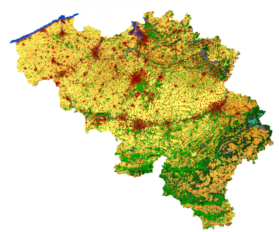
LifeWatch has designed a geographic datacube based on irregular polygons to support
various modelling and mapping purposes. These datacubes provide a flexible representation
of the land cover thanks to their quantitative field. In addition, they provide harmonised
information about soil properties, topography, climate, and spatial context. The datacubes
exist at two different scales: one for Belgium (the ecotopes, based on LifeWatch’s 2 m land
cover) and one for Europe (the ecopatches, based LifeWatch’s 10 m land cover). LifeWatch
provides a series of visualisation tools as well as a point-based extraction tool for quick
data access. Advanced users can of course also download the dataset directly.
Potential vegetation maps
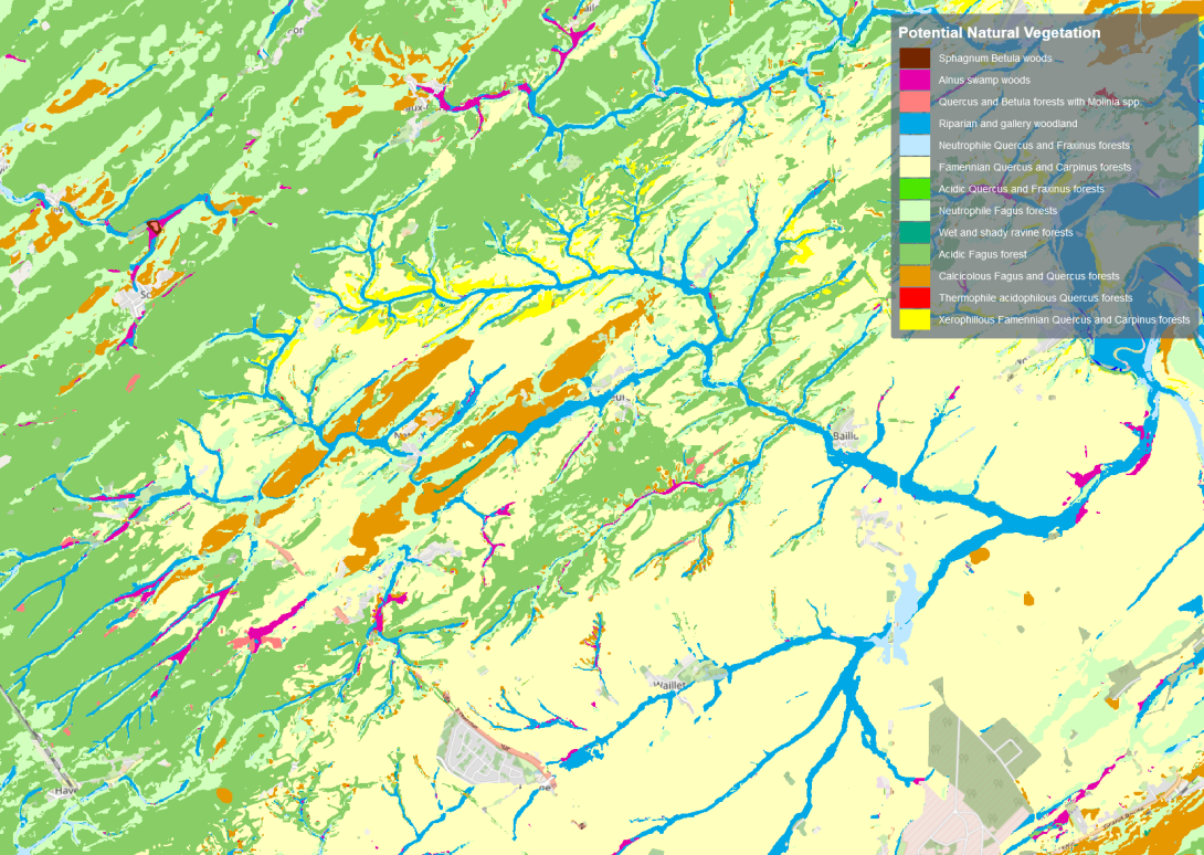
The potential vegetation map is a model based on the environmental variables of the landscape to predict the type of vegetation that could be restored in a given place. This information helps to prioritise the type of ecological network that would bring optimal benefits to the overall biodiversity of the landscape. Combined with the actual land cover, it is also a valuable source of information for underlying species suitability models.
Species abundance maps
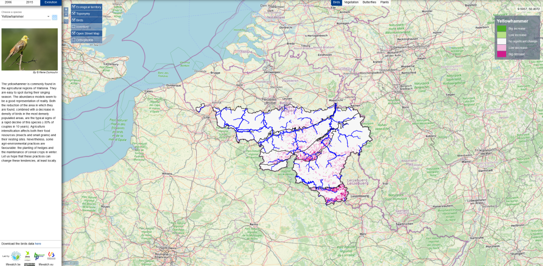
LifeWatch combines advanced models and curated species observation with its base layers to model species abundance. These models are indeed necessary to extrapolate local observation to regional scales. Currently, the results of these models are available for 80 bird species, 20 butterfly species and 35 plant species in the Walloon Region.
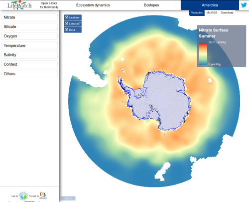
Antarctic environmental data portal
Bio-ORACLE marine modeling layers
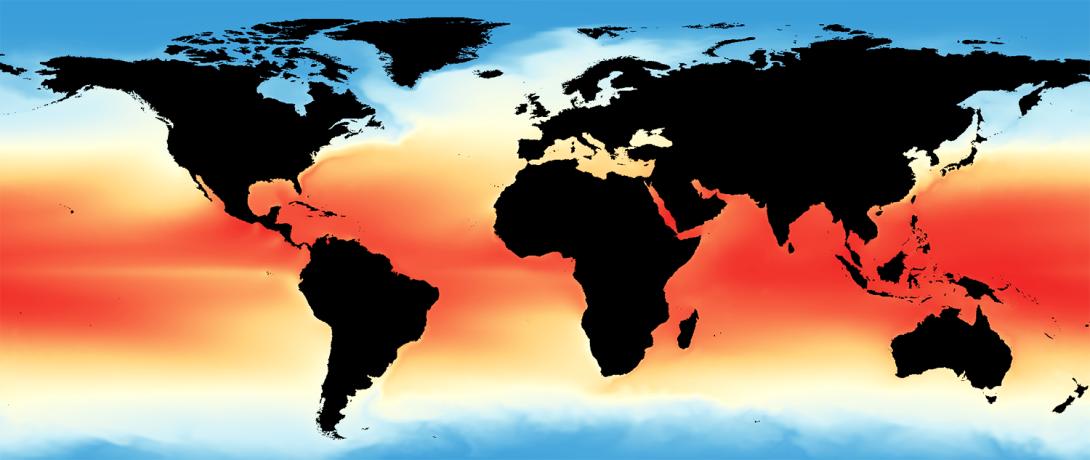
Bio-ORACLE offers essential physical, chemical, biological and topographic data layers with global extent and uniform resolution for modelling the distribution of marine biodiversity. LifeWatch Belgium supports the tools and data infrastructure and web services to access these data layers.
Data & Services
Related stories
-
SeaWatch-B citizen science data confirm climate change 
SeaWatch-B citizen science data confirm climate change
The first report "What is the state of the North Sea?" by the LifeWatch citizen science project SeaWatch-B shows that the Belgian North Sea is affected by human activities, more in particular climate change. Cold-water species such as the North Sea shrimp are decreasing in number compared to a...
-
Finding Ocean Health in a sea of data 
Finding Ocean Health in a sea of data
Ever wondered how the Ocean Health Index gets data for its global assessment of the entire ocean? There's more to it than you'd guess! And Marine Regions is part of the answer!
-
Assessing the state of the oceans 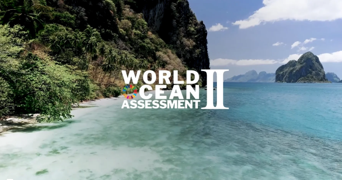
Assessing the state of the oceans
The second World Ocean Assessment – WOA II – is a global exercise by hundreds of marine scientists to evaluate trends and identify knowledge gaps in the world ocean. Two chapters of WOA II have made use of several components of the LifeWatch Species Information Backbone.
-
PETROBRAS: where industry and science touch 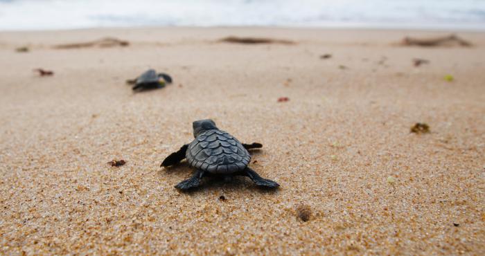
PETROBRAS: where industry and science touch
Environmental responsibility is a hot topic these days! For the Brazilian oil and gas magnate Petrobras, this means caring for the safety of their operations and undertaking actions to balance their activities and the welfare of their workforce and of the communities. By improving products and...
Relevant news
-
Waves of Resonance: An artistic journey with LifeWatch Belgium’s ocean data 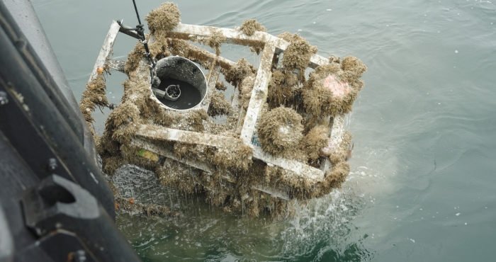
Waves of Resonance: An artistic journey with LifeWatch Belgium’s ocean data
Waves of Resonance is a sound project by artist Elise Guillaume, initiated during the European Marine Board’s EMBracing the Ocean artist-in-residence programme under the UN Decade of Ocean Science for Sustainable Development. She collaborated with Clea Parcerisas (LifeWatch Belgium) and Marine Severin (VLIZ) to explore the psychological impact of marine sounds. LifeWatch Belgium played a key role by providing unique underwater sound data from its observatory in the Belgian part of the North Sea. -
Sevenfold increase in stinging weever fish observed by SeaWatch-B 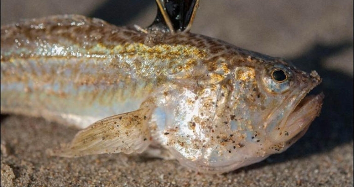
Sevenfold increase in stinging weever fish observed by SeaWatch-B
Between April and late June this year, weever fish counts were seven times higher than during the same period in 2024, according to SeaWatch-B, the citizen science project of the Flanders Marine Institute (VLIZ) under the LifeWatch Belgium Programme. -
Noise pollution in the North Sea 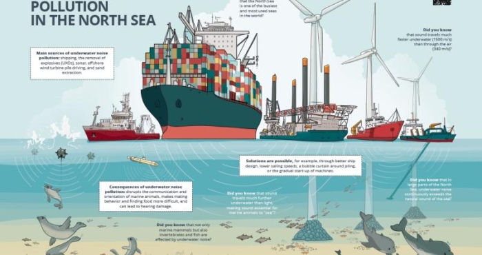
Noise pollution in the North Sea
The North Sea is one of the busiest seas in the world. All this human activity creates a lot of noise underwater. This can have harmful consequences for marine mammals and other organisms in our sea. Fortunately, measures exist to limit noise pollution. The Marine Environment Service (FOD Public Health) and DG Shipping (FOD Mobility), with the support of LifeWatch VLIZ, collaborated on a campaign to raise awareness about underwater noise pollution among the wider public.