

Cnidaria editors participated in the very first WoRMS Cnidaria Workshop
From February 27-29 2024, editors and experts on Cnidaria convened in Ostend to enhance the data and capabilities of their portals and pages in WoRMS.
WoRMS press release: Ten remarkable new marine species from 2023
As for previous years, the World Register of Marine Species (WoRMS) has again released its annual list of the top-ten marine species described by researchers during the past year to coincide with World Taxonomist Appreciation Day on March 19th!
New release of the Bio-Oracle dataset v3
Bio-Oracle provides environmental data of the world ocean for present and future climate change scenarios. These data are mainly used by Lifewatch users to link biodiversity occurrence data to environmental conditions and predict the future distribution of marine species. The new version offers increased spatial and temporal resolution.
Call for nominations for the WoRMS Top-Ten Marine Species of 2023
Once again taxonomists have continued to publish many wonderful new species throughout the last year. As we approach the end of 2023 it is time to think about nominations for The WoRMS Top Ten Marine Species of 2023!
Ocean Census and WoRMS Announce Partnership to Enhance Rapid Discovery and Identification of Marine Life
Collaboration with network of volunteer taxonomic specialists key to mission to accelerate the discovery of ocean life.Corallosphere integrated into the World List of Scleractinia
Back in 2019, the Data Management Team received the request to integrate the content of Corallosphere into WoRMS, and make sure it would also be part of the World List of Scleractinia, one of the WoRMS sub-registers. It took a while, but this integration is now completed!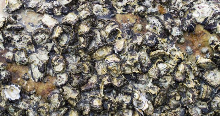
To settle or not to settle? Oyster larvae settlement cues investigated
The inclusion of ecosystem engineers in coastal planning is an approach being considered to mitigate coastal erosion in different environments worldwide. Oysters are reef building and can alter and improve their habitat acting as a barrier for coastal protection by sediment stabilization and wave...
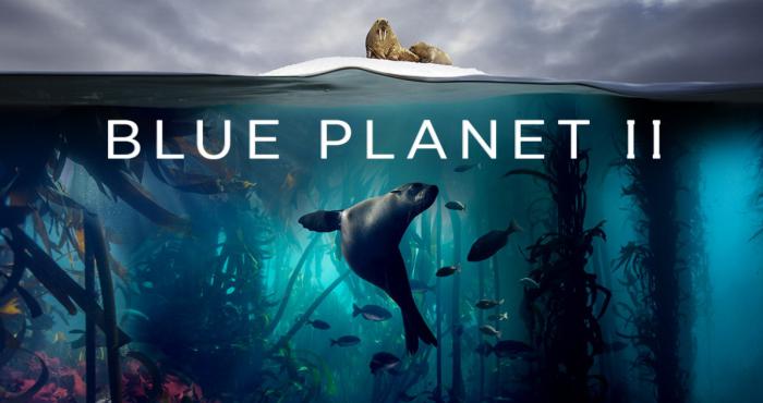
WoRMS featured in Blue Planet II
"Covering almost three-quarters of the Earth's surface, the world’s great oceans are home to an incredibly diverse web of life. The World Register of Marine Species (WoRMS) currently lists just under a quarter of a million species, with new ones being identified all the time. But even as we begin to...
Finding Ocean Health in a sea of data
Ever wondered how the Ocean Health Index gets data for its global assessment of the entire ocean? There's more to it than you'd guess! And Marine Regions is part of the answer!