New data publication: orthophotos and DSMs derived from UAS flights
UAS (unmanned aerial system) images have been processed and published as open data.
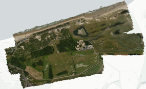
In 2015 and 2016, a total of 38 flights were carried out by the Research Institute for Nature and Forest (INBO) with a fixed-wing unmanned aircraft. During these flights, the INBO drone took images of 4 nature reserves (Zwin, Kalmthoutse heide, Averbode Bos & Heide and Landschap De Liereman) and 1 agricultural field (in Eigenbilzen for quantifying damage caused by wild boar) using RGB and NIR (near infrared) cameras. The resulting raw remote sensing data were processed to digital surface models (DSMs) and orthophotos by the Flemish Institute for Technological Research (VITO).
The INBO archived and published both raw and processed remote sensing data for further use by the scientific community. Cloud optimized GeoTIFFs were created for each processed file. This is the most efficient way to explore the data in GIS software such as QGIS. Orthophotos are available in the RGB (red, green, blue), CIR (color-infrared) or multispec (multispectral) image spectrum. The AWS S3 service is used for data storage. GeoTIFF files of the processed DSMs and orthophotos can be directly loaded in GIS software from the Amazon S3 bucket using weblinks. An overview web page compiles all data files collected with the UAS and provides URLs for loading the raster images in GIS software.
Raw flight data, processed data and ground control points were also published and archived on Zenodo as open data under a Creative Commons Zero waiver. Data from each of the five locations (Averbode Bos & Heide, Eigenbilzen, Kalmthoutse heide, De Liereman, Zwin) were published as separate data packages on Zenodo.
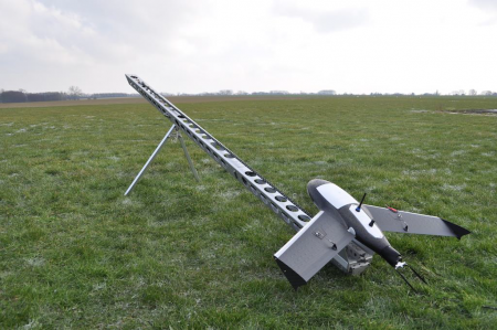

Top - The Gatewing X100 UAS ready to launch; Bottom - Overview of the orthophotos in RGB spectrum taken in the Zwin area.
The INBO archived and published both raw and processed remote sensing data for further use by the scientific community. Cloud optimized GeoTIFFs were created for each processed file. This is the most efficient way to explore the data in GIS software such as QGIS. Orthophotos are available in the RGB (red, green, blue), CIR (color-infrared) or multispec (multispectral) image spectrum. The AWS S3 service is used for data storage. GeoTIFF files of the processed DSMs and orthophotos can be directly loaded in GIS software from the Amazon S3 bucket using weblinks. An overview web page compiles all data files collected with the UAS and provides URLs for loading the raster images in GIS software.
Raw flight data, processed data and ground control points were also published and archived on Zenodo as open data under a Creative Commons Zero waiver. Data from each of the five locations (Averbode Bos & Heide, Eigenbilzen, Kalmthoutse heide, De Liereman, Zwin) were published as separate data packages on Zenodo.


Top - The Gatewing X100 UAS ready to launch; Bottom - Overview of the orthophotos in RGB spectrum taken in the Zwin area.

