News

banner

New data product: Extended Continental Shelves

MarineRegions.org is proud to launch the first version of the Extended Continental Shelves dataset
New data product: Extended Continental Shelves
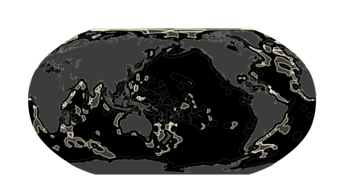
This latest dataset contains the portion of the continental shelf that extends beyond 200 Nautical Miles. Similar to the Exclusive Economic Zones dataset, it consists of both the outer limits of these areas and their polygon representations. Some other noteworthy facts:
  • CLCS & DOALOS
The dataset represents the most recent submission to or recommendation by the Commission on the Limits of the Continental Shelf (CLCS), or deposit with the Division for Ocean Affairs and the Law of the Sea (DOALOS) up to 1 January 2022.
  • Polylines
The polylines dataset included in the download package has different categories, i.e. submission, recommendation, deposit, treaty and connection lines. All the different attributes and their respective sources are documented in the shapefile's attributes.
  • Methodology
A new product requires a new methodology. Find out more about it on the Marine Regions methodology page.
  • Some features are here to stay
Some new features that were introduced with the launch of version 11 of the maritime boundaries geodatabase, were also used in this brand new product, such as the addition of ISO and UN codes, the creation of Pacific-centered maps, and the adoption of a CC BY license.

Downloads of this new version can be found here.
 

Other news